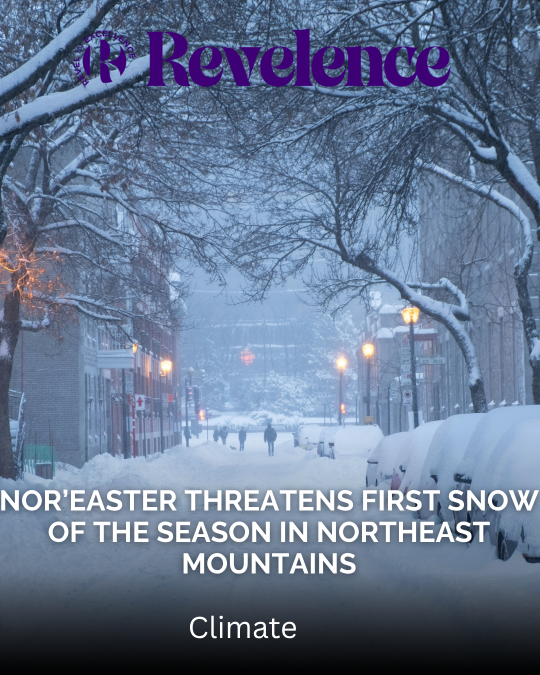
Photo by Shawn Dearn on Unsplash
A late-week storm could bring the first accumulating snowfall of the season to parts of the northeastern United States. However, major East Coast cities are more likely to experience rain and strong winds than significant snowfall.
According to the National Weather Service’s November 9 forecast discussions, a low-pressure system could develop over the Mid-Atlantic on Thursday, November 12. Forecasters expect the system to strengthen into a nor’easter off the coast on Friday, November 13.
The storm could bring wet snow to higher elevations in Pennsylvania, West Virginia, and New York. Meanwhile, Philadelphia, New York City, and Boston are expected to see mainly rain.
However, the forecast remains uncertain. The storm’s eventual path will determine which communities experience snow, rain, or stronger winds.
Pennsylvania mountains could see the first accumulating snow
Western and northern Pennsylvania have some of the strongest chances of receiving accumulating snow.
The National Weather Service office in State College says the northwest mountains and Laurel Highlands could see their first accumulating snowfall late Thursday night through Friday night.
Rain could change to snow as colder air moves into the region. However, snowfall in central Pennsylvania’s valleys remains less certain.
Higher elevations in West Virginia and western Pennsylvania could also experience early-season snow, according to the Weather Prediction Center.
The Poconos and parts of northwest New Jersey could see a rain-and-snow mix. Forecasters say the best chances are along the Interstate 80 corridor, particularly in higher elevations.
Upstate New York and western New England also face some uncertainty. Different forecast models show varying outcomes, ranging from wet snow in the mountains to mostly rain or little precipitation.
Forecasters have not released specific snowfall totals for these areas.
Will New York City, Philadelphia, and Boston get snow?
The latest outlook suggests that major East Coast cities will experience more rain than snow.
Philadelphia and parts of New Jersey could receive significant rainfall from Thursday through Friday night. Gusty north to northwest winds are also possible on Friday.
In New York City and Long Island, rain and gusty northeast winds could develop late Thursday and continue into Friday night. Wet snow may mix into precipitation at higher inland elevations, but forecasters currently expect limited impacts.
Boston and southern New England could also experience rain Thursday night and Friday. Stronger winds are possible on Friday.
One forecast scenario suggests wet snow could reach the eastern Berkshires and higher Worcester Hills on Saturday morning. However, the National Weather Service office in Boston does not currently expect major impacts from that possibility.
Why the nor’easter forecast remains uncertain
The storm’s track remains the biggest question for forecasters.
Weather models disagree about where the low-pressure system will develop and how close it will travel to the Atlantic coast.
The Weather Prediction Center says recent forecasts have generally shifted the expected track south. However, the American GFS model continues to show a different possibility, keeping the storm closer to the New England coast for longer.
A track closer to the coast could bring more rain and stronger winds to coastal communities. Higher inland elevations could receive more snow.
A storm that moves farther out to sea could produce fewer impacts across the region.
Another challenge is the lack of sufficiently cold air before the system arrives. Forecasters say the storm may need to cool the atmosphere before meaningful wintry precipitation develops.
As a result, residents should avoid treating early snowfall projections as confirmed totals.
Colder temperatures and possible first freezes follow
The weather pattern could change significantly after the storm passes.
Colder air is expected to move south across the Great Lakes and into parts of the eastern United States. This could trigger lake-effect rain and snow showers.
Temperatures across the Southeast and Mid-Atlantic could fall 5 to 15 degrees below seasonal averages.
The Ohio Valley and Deep South could also experience their first frost or freeze of the season by Saturday morning, November 14.
In Pennsylvania, Friday and Saturday are expected to bring some of the coldest conditions of the period. Lake-effect and upslope snow could continue into the weekend.
Alaska faces snow and strong winds
While the Northeast waits for its late-week storm, Alaska is already experiencing winter weather.
National Weather Service alerts include a winter storm warning for Haines Borough and Klukwan, where snowfall could reach 8 to 12 inches.
The Anchorage area and lower Matanuska Valley could receive up to 3 inches of snow, a light glaze of ice, and strong wind gusts.
The Anchorage Hillside and Eagle River could see between 2 and 8 inches of snow. Wind gusts could reach 60 mph, particularly across the southern Anchorage Hillside.
Other areas, including Thompson Pass and Turnagain Pass, also face additional snow and strong winds.
What residents should watch this week
For now, forecasters have not confirmed snowfall totals for the Northeast. No winter storm watches had been issued for the region as of Monday morning, November 9.
The next few forecast updates should provide more clarity about the storm’s path and potential impacts.
Residents should monitor local National Weather Service updates, especially if they live in higher elevations or areas prone to coastal flooding.
Travelers should also prepare for changing road conditions and possible delays as the system develops.
For the latest forecast by location, residents can enter their ZIP code at Weather.gov.
Although a major snowstorm is not currently expected for most East Coast cities, the late-week nor’easter could deliver the Northeast’s first mountain snowfall of the season.
Source: Nacionale News
About the Author