Severe weather outbreak threat intensifies across US plains

Courtesy:johannes-plenio from unsplash

Severe weather outbreak threat intensifies is becoming a growing concern across the United States as meteorologists warn of a
dangerous stretch of storms targeting the Plains and Midwest. From Texas to Wisconsin, millions are being urged to stay alert as
conditions become increasingly favorable for tornadoes, destructive hail and strong winds over several days.
Forecasters say this system is not a one-day event but a prolonged period of volatile weather that could disrupt travel, damage
property and pose risks to life. The evolving forecast shows multiple rounds of storms, each bringing its own set of hazards.
Severe weather outbreak threat intensifies into the weekend
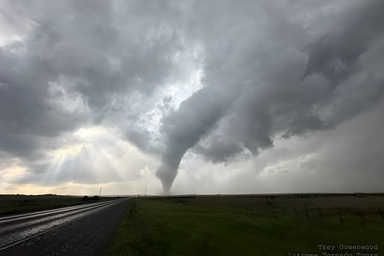
The severe weather outbreak threat intensifies beginning this weekend as a new boundary sets the stage for powerful storms.
Meteorologists highlight the risk of giant hail measuring up to several inches in diameter, along with tornadoes that could reach
significant strength.
Cities across Oklahoma, Kansas and northern Texas are expected to face the most immediate danger. Storms are likely to develop in
the afternoon and grow more intense into the evening hours, increasing the risk of nighttime severe weather.
For readers tracking storm preparedness, you can also explore our guide on staying safe during extreme weather events and
emergency planning essentials.
Saturday brings large hail and tornado potential
Saturday’s forecast includes a strong chance of severe storms forming across parts of the Southern Plains. Atmospheric conditions
such as warm, moist air and wind shear are aligning to support supercell thunderstorms.
These storms are capable of producing large hail and tornadoes that could exceed EF2 strength. Some areas may even see stronger
tornado development if conditions intensify further into the evening.
Sunday expands the risk across central plains
By Sunday, the threat shifts and expands into portions of Kansas, Nebraska and Missouri. The setup remains favorable for rotating
storms that can produce damaging winds and large hail alongside tornadoes.
Major cities in the region are being advised to stay weather-aware as storms could develop rapidly. Even areas with slightly lower risk
levels may still experience disruptive conditions.
For official updates and warnings, visit high-authority sources like National Weather Service and NOAA Storm Prediction Center.
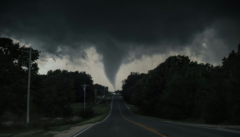
Monday raises concern for long-track tornadoes
The severe weather outbreak threat intensifies further on Monday as the system moves into the Mississippi Valley and parts of
the Midwest. Forecasters warn that this phase could bring some of the most dangerous conditions of the event.
There is potential for long-track tornadoes, which remain on the ground for extended distances and can cause widespread damage.
States including Iowa, Illinois and Missouri are among those being closely monitored.
Urban areas such as Chicago, St. Louis and Indianapolis could face significant impacts if storms hold together into populated regions.
Tuesday keeps storms lingering along gulf coast
While uncertainty increases further out in the forecast, Tuesday may still bring severe storms to parts of the Gulf Coast. The lingering
system could trigger additional thunderstorms from eastern Texas into Alabama.
Although not expected to match earlier days in intensity, these storms could still produce heavy rain, gusty winds and localized
flooding.
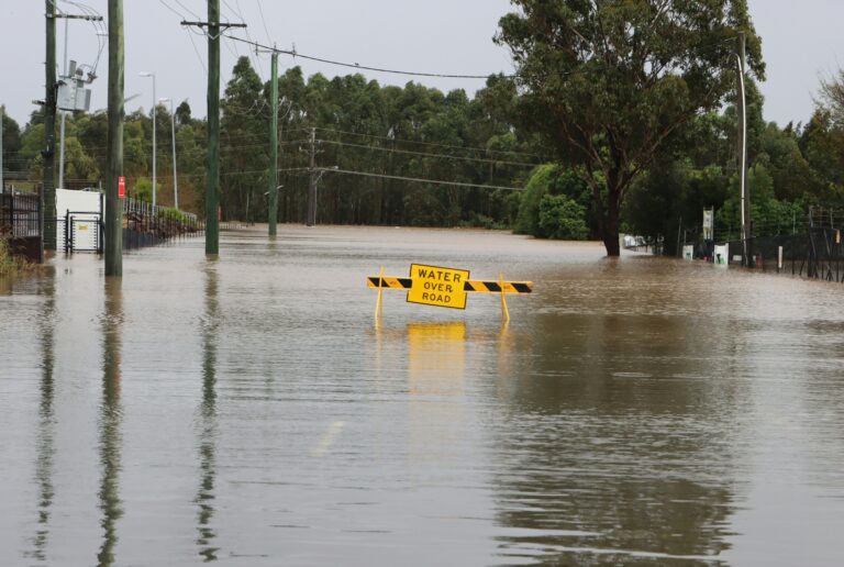
Flood risk adds another layer of concern
Beyond tornadoes and hail, heavy rainfall is expected to create flooding concerns in already saturated areas. Parts of the Midwest and
Great Lakes region could receive additional rainfall that slows recovery from previous storms.
Flash flooding is also possible in regions experiencing drought, where dry ground struggles to absorb sudden heavy rain. Drivers are
urged to avoid flooded roads, especially at night when visibility is reduced.
Recent storms highlight ongoing danger
This latest system follows a week of intense weather activity that produced hundreds of severe storm reports, including dozens of
tornadoes. Some areas now facing new threats were recently impacted, increasing vulnerability.
The pattern underscores how active the season has been and why forecasters continue to stress preparedness. The severe weather
outbreak threat intensifies not just because of the storms ahead, but also due to the cumulative impact on affected communities.
Source: The Weather Channel