South Florida faces dangerous flooding threat today

Photo by Max on Unsplash

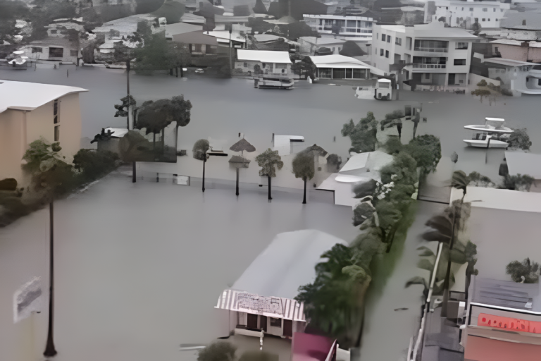
Parts of South Florida are dealing with a growing South Florida flooding threat as heavy rain and thunderstorms continue moving across the region Thursday morning.
Meteorologists warned that repeated downpours could trigger localized flooding in several communities, especially across Miami, Miami-Dade County, Broward County and the Upper Keys.
Weather officials said scattered storms are expected throughout the day with rain chances remaining high into Friday.
The unstable weather pattern already dropped several inches of rain in some areas early Thursday, creating concerns about flooded streets and dangerous driving conditions.
Flood advisories were issued Thursday morning
The South Florida flooding threat intensified after officials issued flood advisories for parts of the region Thursday morning.
A Flood Advisory remained active near Key Largo in the Upper Keys during the early hours of the day. Another advisory covered sections of Miami as rain continued falling across the city.
Forecasters said some neighborhoods already received between 2 and 3 inches of rainfall.
Additional rainfall totals between 1 and 2 inches remained possible later in the day.
Roadway flooding and standing water created travel concerns for drivers during the morning commute.
Thunderstorms are expected through Friday
Forecasters tracking the South Florida flooding threat said the wet weather pattern is expected to continue into Friday.
Meteorologists predicted a 60% to 70% chance of showers and thunderstorms both days, especially during the afternoon and early evening hours.
Some storms could produce heavy downpours capable of overwhelming drainage systems in flood-prone neighborhoods.
Although rain chances may decrease slightly during the weekend, forecasters still expect scattered afternoon storms across the region Saturday and Sunday.
The unsettled weather pattern could continue through at least the middle of next week.
Miami-Dade and Broward remain under flood risk
The South Florida flooding threat remains highest across heavily populated areas including Miami-Dade and Broward counties.
Weather officials placed much of the region under a marginal risk for isolated flash flooding because of persistent rainfall and saturated ground conditions.
Low-lying streets and poorly drained areas face the greatest risk of flooding during stronger storms.
Communities near canals and coastal zones also continue monitoring changing weather conditions as additional rain develops.
Emergency officials urged residents to avoid driving through flooded roadways whenever possible.
Heat and humidity are adding to conditions
Alongside the South Florida flooding threat, residents are also dealing with dangerous heat and humidity.
Forecasters said “feels like” temperatures climbed into the 90s Thursday despite widespread cloud cover and rain.
The combination of tropical moisture, heat and thunderstorms created uncomfortable conditions across the region.
Temperatures are expected to remain in the lower 90s through the weekend before afternoon storms begin developing each day.
The humid conditions also increase the possibility of stronger thunderstorms capable of producing intense rainfall in short periods.
Residents are monitoring changing weather conditions
The South Florida flooding threat quickly became one of the region’s top concerns Thursday morning as residents shared photos and videos of flooded streets online.
Drivers across Miami and nearby communities reported ponding water, reduced visibility and slow-moving traffic during periods of heavy rain.
Local weather teams continue monitoring radar activity throughout the day as new storms move across the region.
Officials encouraged residents to remain weather aware and track updated advisories as conditions continue changing.
The active weather pattern serves as another reminder of how quickly heavy rain can create flooding issues across South Florida during the late spring and summer months.
Source: CBS Miami
About the Author

Praise Swint
Wpseo_editor
Praise Swint is a contributor at Revelence, covering stories across news, entertainment, and culture.