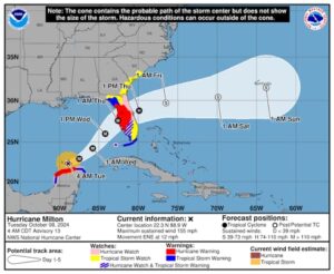
Courtesy:national hurricane center
The National Hurricane Center is updating its hurricane forecasts for the 2026 season with new tools designed to help the public better understand risks and prepare earlier.
New track cone provides inland alerts
The familiar hurricane track cone is getting a major overhaul. For the first time, the updated cone will show tropical storm and hurricane watches and warnings for inland areas, not just coastal regions. This change offers residents away from the shoreline a clearer view of potential wind impacts and risk zones.
Experimental cone shows storm uncertainty
An experimental version of the track cone also offers a more realistic pepective on storm paths. Instead of a single, narrow shape, this version uses a wider range of possibilities to reflect the uncertainty inherent in storm forecasting.
Storm surge maps now cover Hawaii
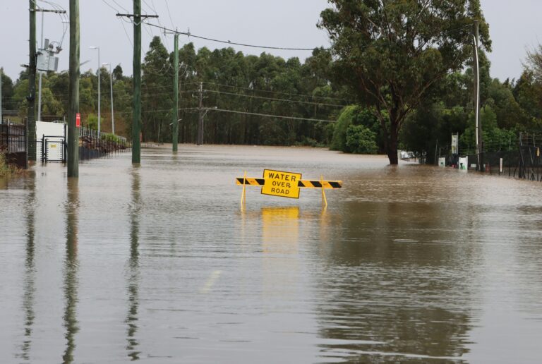
Hawaii will receive storm surge watches, warnings, and detailed flooding maps for the first time. Similar to those already used along the East and Gulf Coasts, these maps show how deep floodwaters could become and highlight areas most likely to experience flooding.
More clarity and lead time for residents
These updates are aimed at giving the public additional lead time and clearer guidance to make safety preparations before a storm hits. Hurricane season officially begins on June 1, and officials encourage residents to stay informed and plan ahead using the new tools.
Source: WEAR First Warning Weather