Courtesy:reza-shayestehpour from unsplash

Central Florida woke up to wet roads, cloudy skies, and cool breezes Wednesday morning. The region is seeing heavy rain coverage, with forecasts predicting up to 80% of the area will experience rainfall throughout the day. Wind and flood advisories remain active, signaling potentially disruptive conditions for commuters and residents alike.
Widespread rain expected
The area is under consistent rainfall, which is likely to continue through much of the day. Morning temperatures hovered around 65 degrees, rising slowly as the day progresses. By midday, readings are expected to reach the low 70s. The persistent rain may impact outdoor activities, errands, and travel, particularly in low-lying areas prone to flooding.
Strong winds adding to hazards
Alongside the rain, strong winds are being reported in multiple Central Florida locations. These conditions can affect tree limbs, power lines, and minor debris, increasing caution for drivers and pedestrians. Residents should secure loose items outdoors and remain aware of changing conditions.
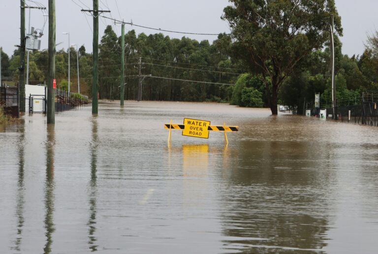
Flood advisories remain in effect
Flood warnings have been issued in areas prone to water accumulation. Motorists are advised to avoid driving through standing water, as even a few inches can pose safety risks. Emergency services continue to monitor high-risk regions to provide assistance where necessary.
Short-term outlook for Thursday
Thursday is expected to remain wet, with scattered showers continuing across the area. However, models suggest a gradual improvement in both wind and precipitation intensity, preparing the region for a more stable weather pattern heading into Friday.
Weekend promises warmth and dryness
By Friday and into the weekend, Central Florida residents can anticipate warmer temperatures and mostly dry conditions. The transition from wet, windy weather to a more typical spring climate will provide relief for outdoor plans and travel. Monitoring local updates will be key to safely navigating the remaining rainy days.
Staying informed with impact weather
“Impact Weather” alerts highlight conditions that may disrupt daily activities or travel plans. Staying updated via local forecasts, apps, and alerts can help residents adjust schedules and remain safe. WESH 2 continues to provide real-time updates for the region, with the First Warning Weather team tracking developments throughout the week.
As Central Florida moves through this rainy stretch, awareness of forecasts and advisories is crucial. While Wednesday and Thursday bring wet, windy conditions, a warmer, calmer weekend is on the horizon.
Source: WESH 2 News