Severe storms threaten Western Pa. with tornadoes and flooding
A tornado warning, severe thunderstorm warning and watch are all active across the region today
Western Pennsylvania is under multiple active weather alerts today as a line of severe storms moves through the region, bringing the threat of tornadoes, damaging winds, hail and flash flooding to dozens of communities.
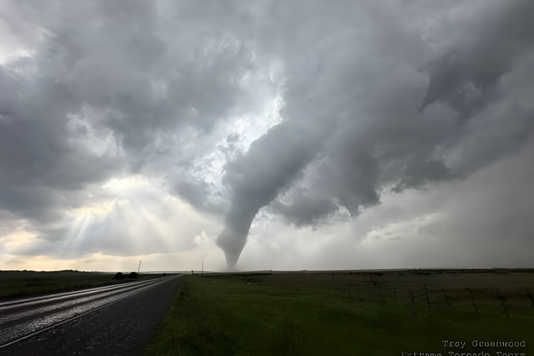
Tornado warning covers three counties
A tornado warning is in effect for parts of Fayette, Washington and Westmoreland counties. Communities under the warning include Connellsville, Monessen, Mount Pleasant, Scottdale, Charleroi, Brownsville, Perryopolis, Belle Vernon and surrounding areas. Residents in those locations should move to an interior room of a well-built structure and stay away from windows until the warning expires.
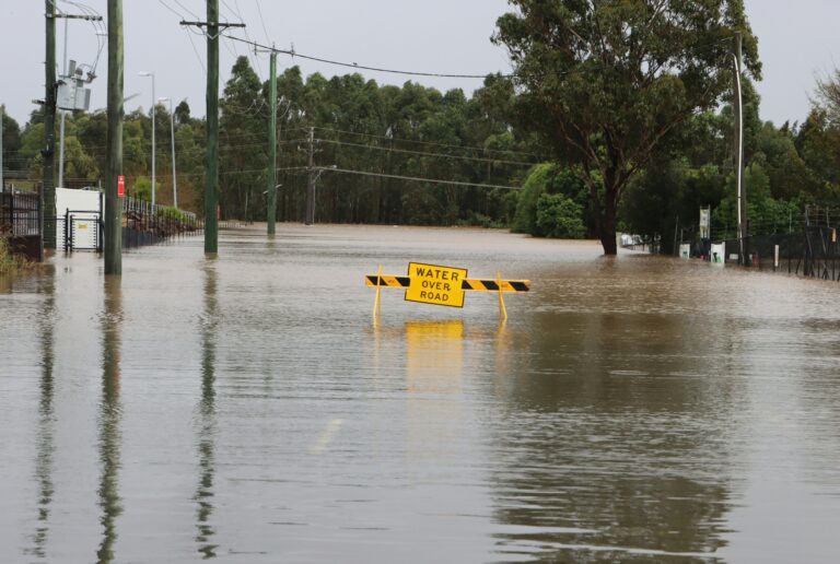
Severe thunderstorm warning for Pittsburgh area counties
A separate severe thunderstorm warning covers parts of Allegheny, Greene and Washington counties. That warning includes Mount Lebanon, Bethel Park, McKeesport, Washington, Canonsburg, Waynesburg and Wheeling, among others. These storms have already produced damaging winds and continuous cloud-to-ground lightning. Torrential rainfall is also occurring and may trigger flash flooding in low-lying and urban areas where drainage can back up quickly. Drivers should avoid flooded roads entirely.
A severe thunderstorm watch has been issued for parts of Ohio, Pennsylvania and West Virginia until 6 PM EDT pic.twitter.com/BXzDvVP9Hw
— NWS Pittsburgh (@NWSPittsburgh) June 6, 2026
Severe thunderstorm watch runs until 6 PM
Beyond the active warnings, a severe thunderstorm watch covers a wider portion of the region through 6 PM. Counties under the watch include Allegheny, Armstrong, Beaver, Butler, Clarion, Fayette, Greene, Indiana, Lawrence, Washington and Westmoreland. Forest, Mercer and Venango counties in Pennsylvania are also included, along with Monongalia County in northern West Virginia.
What to expect through the afternoon and evening
The Storm Prediction Center has rated today’s storm system a two out of five on its risk scale, indicating a slight but real threat of severe weather. Wind gusts up to 70 mph are possible across the watch area, along with the chance of an isolated tornado and hail up to 1.5 inches in diameter, roughly the size of a ping pong ball.
A cluster of storms is moving just south of Pittsburgh through the afternoon. Additional storms could fire up again in the evening, continuing the wind and heavy rain threat before fading after sunset. Lingering storms may carry into early Sunday morning, though they are not expected to reach the same intensity.
Duquesne Light has added extra staff this afternoon to handle downed power lines and outages as the storms move through.
Temperatures stay elevated through the weekend
Today will feel muggy with highs in the mid-80s, though heavy rainfall could keep temperatures from reaching that peak. Overnight lows will sit in the mid-60s. Sunday will be slightly warmer, with Pittsburgh approaching 87 degrees. Temperatures will push close to 90 Monday and Tuesday as drier conditions return.
SOURCE: Post-Gazette